You are using an out of date browser. It may not display this or other websites correctly.
You should upgrade or use an alternative browser.
You should upgrade or use an alternative browser.
All Things Weather
- Thread starter GopherWeatherGuy
- Start date
GopherWeatherGuy
Well-known member
- Joined
- Oct 24, 2013
- Messages
- 17,834
- Reaction score
- 18,032
- Points
- 113
gopher7
Well-known member
- Joined
- Nov 17, 2008
- Messages
- 2,157
- Reaction score
- 996
- Points
- 113
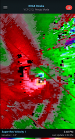
These days it's hard to acheive EF5, but this is about as close as you can get.
GopherWeatherGuy
Well-known member
- Joined
- Oct 24, 2013
- Messages
- 17,834
- Reaction score
- 18,032
- Points
- 113
These days it's hard to acheive EF5, but this is about as close as you can get.
There will be at least a couple EF4s for sure today. We'll see if we get an EF5.
What a wild, wild day. I thought there would be a few tornadoes in that area, but I did not see a historic outbreak coming with dewpoints only around 60, which is the bare minimum you need for these types of tornadoes.
GophersInIowa
Well-known member
- Joined
- Nov 21, 2008
- Messages
- 46,743
- Reaction score
- 31,154
- Points
- 113
GophersInIowa
Well-known member
- Joined
- Nov 21, 2008
- Messages
- 46,743
- Reaction score
- 31,154
- Points
- 113
gopher7
Well-known member
- Joined
- Nov 17, 2008
- Messages
- 2,157
- Reaction score
- 996
- Points
- 113
Reed Timmer is taking note.
Slim Tubby
Well-known member
- Joined
- Nov 21, 2008
- Messages
- 9,376
- Reaction score
- 11,502
- Points
- 113
Joel...not so much.Reed Timmer is taking note.
GophersInIowa
Well-known member
- Joined
- Nov 21, 2008
- Messages
- 46,743
- Reaction score
- 31,154
- Points
- 113
I’m pretty sure that isn’t a trailer but it’s still pretty crazy
Gopher_In_NYC
Well-known member
- Joined
- Apr 19, 2010
- Messages
- 24,522
- Reaction score
- 17,068
- Points
- 113
Crazy story about Two brothers in Elkhorn that survived the tornado there that demolished their house - they were upstairs looking for their  and got spun around and spit out by it -
GophersInIowa
Well-known member
- Joined
- Nov 21, 2008
- Messages
- 46,743
- Reaction score
- 31,154
- Points
- 113
GophersInIowa
Well-known member
- Joined
- Nov 21, 2008
- Messages
- 46,743
- Reaction score
- 31,154
- Points
- 113
GophersInIowa
Well-known member
- Joined
- Nov 21, 2008
- Messages
- 46,743
- Reaction score
- 31,154
- Points
- 113
GophersInIowa
Well-known member
- Joined
- Nov 21, 2008
- Messages
- 46,743
- Reaction score
- 31,154
- Points
- 113
short ornery norwegian
Well-known member
- Joined
- Feb 9, 2011
- Messages
- 21,873
- Reaction score
- 15,872
- Points
- 113
well, it has been raining almost non-stop in my neck of the woods - SW MN, NW IA and SE SD.
which has led to a lot of localized flooding. several highways have been closed in the area including portions of I-90 and many rural and county roads.
as a result, the West Fork of the Des Moines River in Windom is currently at 23.2 feet - which is the 3rd highest level ever recorded. at this point, the weather folks are predicting that the river will crest at 24 feet by late Tuesday or early Wednesday. at that level, some homes next to the river will be in danger of flooding. and Island Park - where the HS football and baseball fields are located, is already under water.
the last time the river got this high, the football field was under water so long that the grass died and the HS football team had to play all of its games on the road the next season while they repaired the facility. I hope it doesn't come to that again.
GophersInIowa
Well-known member
- Joined
- Nov 21, 2008
- Messages
- 46,743
- Reaction score
- 31,154
- Points
- 113
short ornery norwegian
Well-known member
- Joined
- Feb 9, 2011
- Messages
- 21,873
- Reaction score
- 15,872
- Points
- 113
flood update in Windom, MN.
went out and walked around this morning. it's nuts.
West Fork of Des Moines River at 24.49 feet as of 10:15 this morning. NOAA is now forecasting that the river could set a new all-time high level at 25-feet tomorrow morning. previous record 24.7 feet, set in 1969 - so looking at highest river levels in 55 years.
didn't walk down by the golf course but several holes are typically underwater at 23-feet, so with the river potentially 2 feet higher, the golf course is in trouble.
the entire HS baseball and football field is under several feet of water and that will continue for at least a week. will have to wait until the water recedes to see how bad the damage is.
over by the High School, Perkins Creek is also higher than I've ever seen. several houses by the Creek are sandbagging in hopes of keeping the water out of the main floor. basements are all flooded - sump pumps can't keep up. (the High School looks safe)
in case anyone is wondering, I live on the East Hill- the highest elevation in Windom. so I'm high and dry.
short ornery norwegian
Well-known member
- Joined
- Feb 9, 2011
- Messages
- 21,873
- Reaction score
- 15,872
- Points
- 113
hey - if anyone is interested in seeing pictures and video of the situation in Windom, there is a lot of material on the KDOM Radio Facebook page, including a drive-by video of the baseball/football field. As I type this, looks like we're going to get another little shot of rain this afternoon.
must be my fault - I was going to try and mow my lawn, but now I guess it'll wait until Sunday.....or maybe Monday.......
must be my fault - I was going to try and mow my lawn, but now I guess it'll wait until Sunday.....or maybe Monday.......
Ope3
Sailor Sam
- Joined
- Dec 12, 2008
- Messages
- 13,598
- Reaction score
- 10,463
- Points
- 113
My hometown area Northfield-Dundas as part of the entire Cannon River Valley is also experiencing major issues.flood update in Windom, MN.
went out and walked around this morning. it's nuts.
West Fork of Des Moines River at 24.49 feet as of 10:15 this morning. NOAA is now forecasting that the river could set a new all-time high level at 25-feet tomorrow morning. previous record 24.7 feet, set in 1969 - so looking at highest river levels in 55 years.
didn't walk down by the golf course but several holes are typically underwater at 23-feet, so with the river potentially 2 feet higher, the golf course is in trouble.
the entire HS baseball and football field is under several feet of water and that will continue for at least a week. will have to wait until the water recedes to see how bad the damage is.
over by the High School, Perkins Creek is also higher than I've ever seen. several houses by the Creek are sandbagging in hopes of keeping the water out of the main floor. basements are all flooded - sump pumps can't keep up. (the High School looks safe)
in case anyone is wondering, I live on the East Hill- the highest elevation in Windom. so I'm high and dry.
Dundas Memorial Park, home of the Dukes (and Windom legends the Olson brothers) is under water. The Carleton practice fields are submerged, so I would guess it's a matter of time for Laird Stadium to also be flooded as well, if not already.
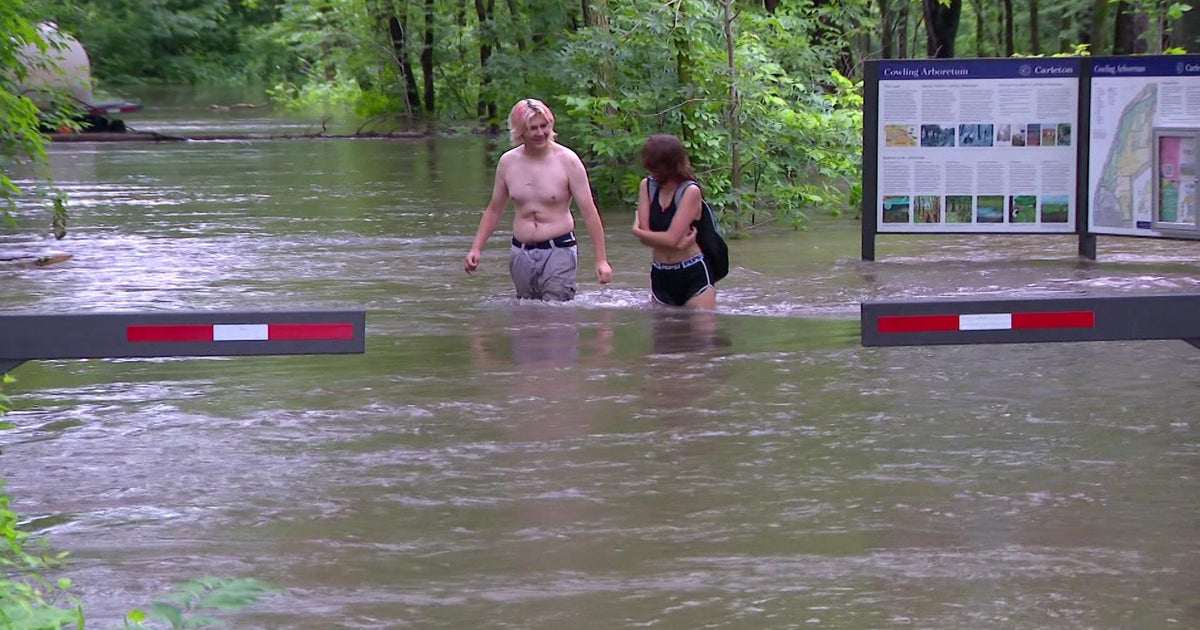
Cannon River in Northfield crests at possible record height
Experts believe the Cannon River finally crested in Northfield on Sunday evening, reaching 901.52 feet above sea level.
Ope3
Sailor Sam
- Joined
- Dec 12, 2008
- Messages
- 13,598
- Reaction score
- 10,463
- Points
- 113
Dundas Memorial FieldMy hometown area Northfield-Dundas as part of the entire Cannon River Valley is also experiencing major issues.
Dundas Memorial Park, home of the Dukes (and Windom legends the Olson brothers) is under water. The Carleton practice fields are submerged, so I would guess it's a matter of time for Laird Stadium to also be flooded as well, if not already.

Cannon River in Northfield crests at possible record height
Experts believe the Cannon River finally crested in Northfield on Sunday evening, reaching 901.52 feet above sea level.www.cbsnews.com
Ope3
Sailor Sam
- Joined
- Dec 12, 2008
- Messages
- 13,598
- Reaction score
- 10,463
- Points
- 113
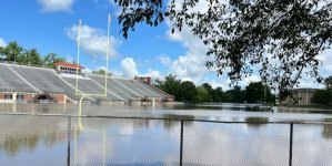
Laird Stadium at Carleton College.My hometown area Northfield-Dundas as part of the entire Cannon River Valley is also experiencing major issues.
Dundas Memorial Park, home of the Dukes (and Windom legends the Olson brothers) is under water. The Carleton practice fields are submerged, so I would guess it's a matter of time for Laird Stadium to also be flooded as well, if not already.

Cannon River in Northfield crests at possible record height
Experts believe the Cannon River finally crested in Northfield on Sunday evening, reaching 901.52 feet above sea level.www.cbsnews.com
GophersInIowa
Well-known member
- Joined
- Nov 21, 2008
- Messages
- 46,743
- Reaction score
- 31,154
- Points
- 113
Apparently there’s radar estimates of up to 18 inches in that area.
short ornery norwegian
Well-known member
- Joined
- Feb 9, 2011
- Messages
- 21,873
- Reaction score
- 15,872
- Points
- 113
not over yet. river dipped in Windom over the weekend, but it's coming up again as water from the North works down the river. new forecast is predicting a possible crest of 26-feet on Wednesday. at that level, a lot of homes and businesses are going to be flooded.
the previous record was 24.7 feet, which was surpassed this morning. now at 24.74 feet.
in the Heron Lake area, it's a real mess. and Jackson, MN is facing a similar situation. down in Iowa, Spencer IA is almost completely flooded.
I'm just hunkered down. damn glad I bought a house up on the hill. before I bought this one, I looked at a house on River Road. as you can guess from the name, it's next to the river.
GophersInIowa
Well-known member
- Joined
- Nov 21, 2008
- Messages
- 46,743
- Reaction score
- 31,154
- Points
- 113
Oh no
short ornery norwegian
Well-known member
- Joined
- Feb 9, 2011
- Messages
- 21,873
- Reaction score
- 15,872
- Points
- 113
well, I spent 2-1/2 hours helping to fill sandbags today in Windom. (I'm too old for manual labor...)
had to stop when they ran out of sandbags. they are getting more bags from other cities in MN and the US Army Corps of Engineers. Natl Weather Service now predicting a crest of 26 feet on Wednesday - 1.3-feet higher than the previous record. they are putting up sandbags in front of Hy Vee and other businesses on Highway 60 along with the city Electric Plant.
had to stop when they ran out of sandbags. they are getting more bags from other cities in MN and the US Army Corps of Engineers. Natl Weather Service now predicting a crest of 26 feet on Wednesday - 1.3-feet higher than the previous record. they are putting up sandbags in front of Hy Vee and other businesses on Highway 60 along with the city Electric Plant.
FinnGopher
Well-known member
- Joined
- Mar 27, 2023
- Messages
- 3,427
- Reaction score
- 3,506
- Points
- 113
I take it the Des Moines is still rising. I had relatives in Mt Lake and saw the Des Moines flood out the ballfield and pool in Windom on a few occasions, but seeing the water up around Duffy's and the HyVee is new. I'm sorry for the struggles Windom has faced in the past couple years with this and the loss of the processing plant.well, I spent 2-1/2 hours helping to fill sandbags today in Windom. (I'm too old for manual labor...)
had to stop when they ran out of sandbags. they are getting more bags from other cities in MN and the US Army Corps of Engineers. Natl Weather Service now predicting a crest of 26 feet on Wednesday - 1.3-feet higher than the previous record. they are putting up sandbags in front of Hy Vee and other businesses on Highway 60 along with the city Electric Plant.

